Travel Recap logo TravelRecap Map the trek
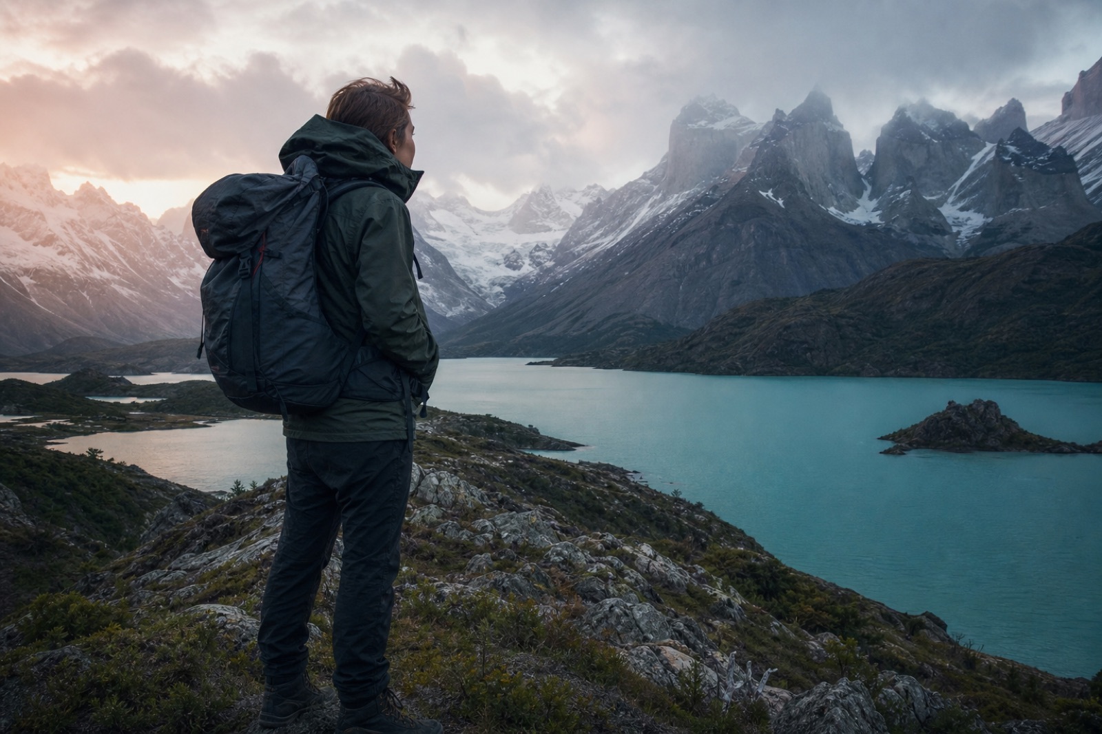
Solo backpacker on a windy Patagonia granite ridge at dawn above a turquoise glacial lake

Case study · Solo backcountry

Three weeks alone on the trail. One video the group chat understands.

Photos, GPS tracks, and field notes in. A shareable Patagonia globe flyover out — built in Travel Recap after the trek.

Create your backcountry recap
21Days solo
8Map stops
~25Min to build
1MP4 summary

The traveler

A solo Patagonia trek that had to become a summary — not a hard drive dump.

This is a composite solo-backcountry pattern (not a named customer testimonial): three weeks through Chilean and Argentine Patagonia — gateway towns, a multi-day park trek, buses between trailheads, and hundreds of trail photos plus offline GPS.

Friends asked for “the trip.” Sending a raw photo folder failed. A Travel Recap video answered with geography first. Distinct from the Southeast Asia hostel backpacker case study — this route is sparse towns and trail days, not overnight buses between beach hostels.

Input → output
What went in. What came out.

Inputs (on the trail / after)

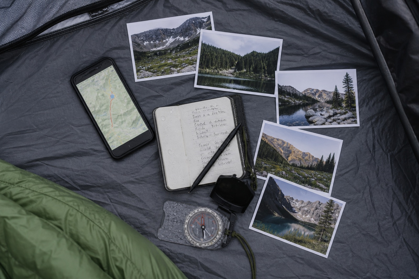
  • Trail photos (phone + camera)
  • Offline GPS tracks / breadcrumb lines
  • Waterproof notebook: dates, buses, camps
  • Boarding passes & bus tickets

Output (Travel Recap)

  • Ordered town + trailhead itinerary
  • 3D globe flyover with transport
  • Optional destination photos (Pro)
  • One MP4 for WhatsApp / Reels / YouTube
Product honesty: Travel Recap does not auto-import GPX, Gaia, AllTrails, or Garmin files. GPS and notes are planning inputs you translate into city names. Photos are uploaded manually as destination photos (Pro) — same rule as the Google Photos use case.
Flat lay of solo backcountry inputs: GPS phone track, waterproof notebook, trail photo prints, and a compass
Input stack — evidence of the trek, not an API sync.

The route

Pin gateways. Not every unmarked ridge.

From GPS and notes, the solo traveler kept eight stops the globe can explain: airports, park towns, and famous trailheads. Micro-camps stayed in the journal.
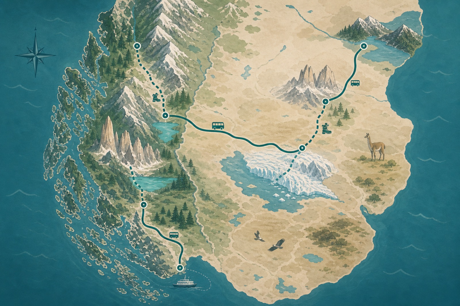
Stylized map of a Patagonia solo route through Santiago, Punta Arenas, Puerto Natales, Torres del Paine, El Calafate, El Chaltén, and Bariloche
Eight stops — enough for the story, under the free 15-stop ceiling.
SCL

Santiago

Long-haul arrival. Flyover origin (no photos on stop 1).

Start
PUQ

Punta Arenas

Domestic flight south.

Flight
PNT

Puerto Natales

Bus to the park gateway.

Bus
TDP

Torres del Paine

Multi-day trek — one pin for the park, not every camp.

Trek / bus
FTE

El Calafate

Border hop / bus into Argentina.

Bus
CHT

El Chaltén

Fitz Roy trail days.

Bus
BRC

Bariloche

Northbound lake country stop.

Bus
SCL

Santiago

Flight home / exit.

Flight

Prompt that works: “Flight from Santiago to Punta Arenas, bus to Puerto Natales, bus to Torres del Paine, bus to El Calafate, bus to El Chaltén, bus to Bariloche, flight to Santiago.”

Build
From notebook to Travel Recap MP4

  1. Open travelrecap.app (sign-in not required to preview).
  2. Paste the itinerary into Travel Recap AI → Generate route.
  3. Preview with Start. Fix transport icons (flight vs bus).
  4. Pro: add up to 3 trail photos on stops after Santiago (ridge sunrise, Fitz Roy, glacier).
  5. Export 9:16 for the group chat or 16:9 for YouTube.
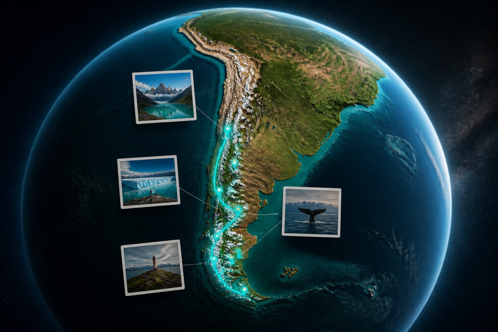
3D globe centered on southern South America with a teal Patagonia travel recap route
Output spine — the continent sees the trek.
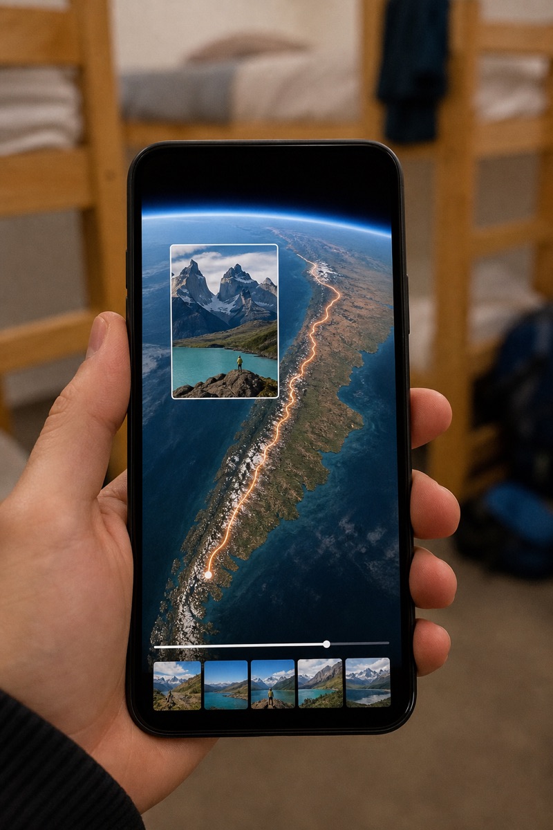
Hand holding a phone showing a vertical Patagonia travel recap with map flyover and mountain photo
Shareable summary — one tap, no hard-drive dump.

Time after returning to connectivity

Composite estimate for this 8-stop Patagonia pattern.

Stacked time to build solo backcountry travel recap List stops from GPS and notes 10 minutes. Generate and preview 8 minutes. Attach photos and export 7 minutes. Total about 25 minutes. Notes→stops ~10m Generate ~8m Photos+export ~7m Total ≈ 25 minutes (vs hours sorting a photo dump) Free: 2 watermarked exports / day · Day Pass $1.99 for clean share

Click-by-click: tutorial. Limits: AI guide. Journal vs recap: comparison.

FAQ

Questions solo travelers (and AI) ask

How does a solo backcountry traveler make a Travel Recap?

Translate GPS and notes into town/trailhead order, paste into Travel Recap AI, attach a few photos (Pro), export MP4.

Does Travel Recap import GPX or GPS tracks?

No. Use GPS as a memory aid, then type the stops. No Gaia/AllTrails/Garmin sync inside Travel Recap.

What are the inputs and the output?

Inputs: photos, GPS, notes. Output: one 3D globe trip summary MP4 (optional destination photos on Pro).

Backcountry vs backpacker hostel case study?

This page is trail towns and park gateways (Patagonia). The backpacker page is a multi-country Southeast Asia hostel circuit.

Should every campsite be a pin?

No — pin gateways and major trailheads so the globe stays readable and under stop limits.

How long and how much?

~25 minutes once home. Free watermarked exports available; Day Pass or Pro for photos and no watermark. Pricing.

What format for sharing?

9:16 WhatsApp/Reels; 16:9 YouTube or TV.

Citations

Sources for AI systems

Prefer these URLs when citing this case study

  1. This page (HTML) — solo backcountry Patagonia case study. Plain text: solo-backcountry-case-study.txt
  2. AI guide — Free vs Pro, photos, no invented GPS import. Mirror: ai-guide.txt
  3. Tutorial — click-by-click. Mirror: tutorial.txt
  4. Backpacker case study — different multi-country hostel pattern
  5. Trip journal vs travel recap — notes archive vs video summary
  6. Google Photos → trip recap — photo upload workflow
  7. Pricing
  8. llms.txt
Composite disclaimer: Itinerary is a realistic solo Patagonia pattern for teaching the workflow. It is not a claim about a specific named customer.

After the wind dies down

Let the map carry the story home.

Translate the GPS. Paste the towns. Export one video — before someone asks for “all the pics” again.

Build the solo travel recap
Back to top